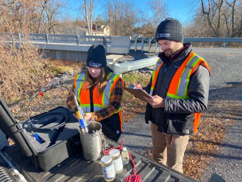
SDG COUNTIES, Ontario - On many a crisp, bright morning, the Raisin Region Conservation Authority’s Scott Braithwaite and Claudia Munafo travel across the RRCA’s watershed jurisdiction in eastern Ontario. They stop at nine different locations by the Raisin, Beaudette, Garry, and Delisle rivers, where, armed with a bucket on a rope and a state-of-the-art water quality probe, they capture water samples and harvest select data, including oxygen levels, temperature, turbidity, and water conductivity.
The collected water samples are sent to a lab for analysis.
The RRCA repeats this process every month, from spring to fall, and has been doing so for nearly 50 years.
“Regular monitoring is an invaluable tool to assess long-term changes in water quality,” said Braithwaite. “A better understanding of environmental trends in our watershed can help us focus actions where they are needed most.”
Braithwaite compares it to monitoring a person’s vital signs.
“By consistently keeping our finger on the pulse of the watershed, from surface and ground water quality to snowpack conditions, we can use science to inform our decisions when offering programs and services to our municipalities, from sustainable development and landowner stewardship to drinking water source protection and flood forecasting and warning," he said.
Since 1976, the RRCA has been a participant in Ontario’s Provincial Water Quality Monitoring Network. Administered by the Ministry of the Environment, Conservation and Parks, the Network gathers surface water quality information from strategic locations across Ontario. Most of this data is collected by Ontario’s 36 conservation authorities, whose jurisdictions are organized on a watershed basis – this provides an advantage in coordinating the effort and complements other conservation authority monitoring programs.
Water quality results from Ontario’s Provincial Water Quality Network are accessible to everyone through an online, interactive map, which can be accessed at rrca.on.ca/SurfaceWater.
